
Seneca Creek Trail
In our time exploring and adventuring around West Virginia, we occasionally come across a trip that, for whatever reason, escapes us. A trip that we talk about, plan for, and just can't... quite... get done. This is a story about us finally experiencing Seneca Creek, a trip that we had talked about for more than 4-years. Seneca Creek is nearly 20-miles long, and rises on the flanks of Spruce Knob, deep in the Spruce Knob-Seneca Rocks National Recreation Area. It flows through the Seneca Creek Backcountry, a roughly 24,000 acre roadless area bounded by Gandy Creek to the west and FR112 to the south and east. You read that right - roadless. To experience and explore the trip described here, you can't get there by car. Perfect for us.

Campsite along Gandy Creek
Getting Close
As mentioned, we had talked about this trail for years - so what was the holdup? For starters, the top of Spruce Knob is close to... nothing. It's a full 3 hours from our home base in Morgantown, which meant that we had to find a full day to accomplish this trip - no driving down the morning of, and knocking it out. Secondly, our main destination on this trip was the Upper Falls of Seneca Creek - more than 5-miles, one way, from the trailhead, with multiple creek crossings along the way. This meant that we were looking for a rare combination of conditions - plenty of time, good weather, and enough water in the creek to show off the waterfall, without having so much water as to make the crossings dangerous. We got our perfect conditions at the tail end of an oddly-delayed spring in April 2018 - a warm day, with good flow, and a completely open weekend - a sweet spot for an adventure that we had waited a long time to attempt.
We headed down on a Friday evening, and found camping along the Gandy Creek - still 30 minutes from the trailhead, but close enough to make our single-day hike possible. The sites along Gandy Creek are beautiful, and we enjoyed our first night of camping in months out under a starry sky, talking over the campfire and listening to the creek rushing beside our campsite. The white noise from the water lulled us to sleep, leaving us rested up for the next days hike.
Railroad Grades, Springs, and History
Getting up the next morning, our drive to the trailhead took us past Spruce Knob Lake, which was very busy with fishermen. Arriving at the trailhead, the parking area was full - a surprise to us, but we decided that we were going to go for it regardless. The Seneca Creek Trail is the main artery through the backcounty, the primary trail that follows the creek for nearly 12 miles, which helps explain its popularity. We decided to "lightweight" our packs - committing to getting in and out in one day, but did take plenty of water and a camp stove and meal to tide us over at the halfway point. Additionally, we made sure to take our water shoes, and one of us (Carmen) remembered to take their trekking poles. We set off in mid-morning sun, excited for our day.
The upper part of the trail is one of the most beautiful, and un-characteristic hikes in all of West Virginia. The trail follows a turn of the century railroad grade, and was pleasant walking in good conditions for the first few miles. It winds slowly through hemlock and pine tunnels - a rarity in our fairly temperate state - and the smell and sound of wind through the trees had us refreshed and invigorated as we started down the trail. At about the second mile, we encountered our first "real" creek crossing, and swapped our footwear. We swapped back to boots on the other side, and headed for the first major landmark on the trail, Judy Springs.
Judy Springs
Judy Springs Campground
At roughly mile 3 from the car, you enter the field at the Judy Springs Campground. From what I gather, this campground was a logging camp, long long ago, and was converted to a forest service campground, accessible by car up until the 1970s. These days, it's a lovely, wideopen area, and a common overnight spot for hikers looking to take a couple of days in Seneca Creek. When we arrived, there were several tents and people scattered around the clearing - these were the first campers that we encountered, but they would be a steady presence from Judy Springs on down.
Judy Springs Campground is named for Judy Springs, which rise just above the campground and flow into Seneca Creek at the campground. These springs are a significant tributary in these upper reaches of the creek. It's a surprising scene, to see a stream rise, fully formed, from under the mountain.
Continuing past Judy Springs, the trail became more challenging and rugged - a short distance from the campground, we encountered our second ford of the day, and switched to water shoes for the next several miles. The creek and the setting are incredibly beautiful in this section - cascading over rock ledges, reflecting the rhododendron, and teeming with trout that are visible from the trail. There are distributed campsites all along this portion of the trail, all of them in beautiful positions near the creek - and every one of them seemed to be occupied as we walked down on a Saturday morning. After a bit of a rock scramble, we encountered our third creek crossing, and then a fourth. As we reached this lower end of our hike, we met several hikers headed back up the trail, and finally reached our destination - the Upper Falls of Seneca Creek.
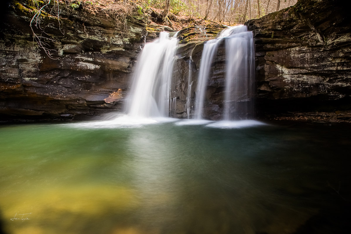
Upper Falls of Seneca Creek
Waterfalls with Friends
As we crossed the creek for the last time on our descent, we really caught view of the trail's railroad history - the trail parallels a trestle base at the top of the waterfall. As we crossed the creek, we realized that a whole church youth group was swimming at the base of the falls, truly impressive to me, as my feet were tingling from the cold water on our crossings to this point. We set up the camp stove, and boiled water for a warm lunch, while watching the kids play at the waterfall. We took note of some long sections of railroad rail in the creekbed, and I wondered how long they had been there, and if they were washed there from a long-ago flood, or were just tossed there when the trail was constructed.
I didn't have too much time to further think on this point, as the food was ready, and the kids were starting to pack up, and we ate a well earned - and as it would turn out, well needed - meal, and set up to photograph the waterfall.
6 miles and 1,000 feet

One of Eight Creek Crossings
With a reasonably full belly, we started the trip back to the top. We did this hike as an "out and back", so we retraced our steps, photographing things along the way to help slow the climb. I had estimated the journey at 10 miles round trip, but my hiking GPS put us at 6 miles to our turnaround point at the waterfall - meaning we were going to have a pretty big day. We left the waterfall, and met more hikers headed in for their dose of wilderness. As we hiked along, we talked with folks camping along the creek, including a large group that had set up a solid looking base camp, ready to spend a week by the looks of things. After a couple of miles, and repeating the lower creek crossings, we returned to Judy Springs, and did this short side-hike up to the spring itself. Feeling adventurous, we drank straight from the spring (repeat at your own risk!), and Carmen added to her experience - having a little slip, where she did her best to fall headfirst into the spring. Uninjured, we picked up and continued, chewing through the 6 miles, and 1,000 feet of elevation gain from the falls.
By the upper reaches of the trail, we were definitely starting to fade - and started to understand why most folks break up this hike into a couple of days, versus the single day push we were working on. Even with our fatigue, the trail never lost its beauty, and stayed inspiring and beautiful all the way back to the car.
Bringing It Home
Reaching the parking lot, we were hungry, weary, and happy. The GPS said we had covered 12.2 miles and roughly 1,500 feet of elevation gain, with a total of 8 creek crossings - not a bad days work, and more than I would have guessed in walking an old rail grade. Overall, the hike was a gem, through beautiful country, even if it was a bit more crowded than I had hoped or expected. In honesty, it's easy to see why this is popular trail, right in the sweet spot of pleasant hiking, beautiful campsites and beautiful scenery, while still letting you feel like you've "earned it" when you reach your destination. I hope that we don't wait another 4 years to return.

Route Map - 12.2 miles measured out and back

Upper Trail Evergreen Tunnel

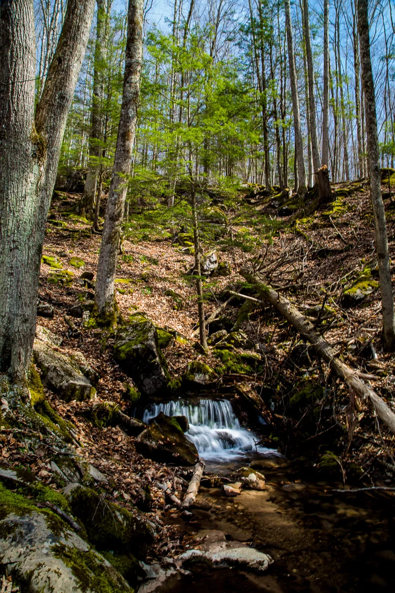
Unnamed Tributary of Seneca Creek